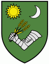
Bácsalmás
 |
In the Middle Ages, the region came under the control of the Magyars who absorbed the Slavic and the remnant Avar population. There was archaeological evidence found in various small villages in the Middle Ages. The area was under the ownership of János Hunyadi in the 15th century. With the arrival of the Turks, the population disappeared and was at first replaced by Bunjevci who came from Bosnia and the Croatian Littoral. The first mention the village comes from 1543 in the records of the Archbishopric of Kalocsa.
In the 17th century, there was a steady influx of Bunjevci under the leadership of the Franciscans from Bosnia. The last major group came under the leadership of captains Marković and Vidaković.
With the Turkish defeat at the Battle of Zenta, Bácsalmás came under the control of the Habsburgs where it became a part of the Military Frontier. In 1772, the village received an Urbarium form in the Bunjevac language, which reflected the majority of the population. The Urbarium was for the landowners of the village consisting of 72 Bunjevci, 11 Hungarians, 3 Slovaks and 2 Romani. In the 1780s, 195 German families were settled by the Habsburgs in Bácsalmás who continued to be the overwhelming majority until 1945. Most of these settlers came from Swabia, Alsace and Mainz. In the following decade, land grants were given to newly ennobled men from the immediate region to the Hungarian family of Németszeghy, Koronay, and Bunjevac families of Antunović, Rudić, Kovačić, and Šišković.
In the 19th century the town became a centre for wine and grain production which was exported mainly to Austria and Bohemia. It also became an important railroad junction. In effect it became a prosperous community. However, it retained its rural character the whole time with a strong artisan class which served the surrounding region.
In 1941, the town had a population of 13,000, two-thirds of whom were Germans (Danube Swabians). In 1945–46, the majority of Germans were expelled and Hungarians were brought from Slovakia to replace them.
In 1986, Bácsalmás became a town with a population of over 8,000. With the closure of some industries and the reforms in agriculture, the town is losing its population. Bácsalmás is struggling to replace the declining agricultural sector, but alternatives are hard to find. The farming cooperative privatized in the early 1990s and the local state farm accumulated large debts.
Map - Bácsalmás
Map


Country - Hungary
 |
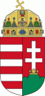 |
| Flag of Hungary | |
The territory of present-day Hungary has for centuries been a crossroads for various peoples, including Celts, Romans, Germanic tribes, Huns, West Slavs and the Avars. The foundation of the Hungarian state was established in the late 9th century AD with the conquest of the Carpathian Basin by Hungarian grand prince Árpád. His great-grandson Stephen I ascended the throne in 1000, converting his realm to a Christian kingdom. By the 12th century, Hungary became a regional power, reaching its cultural and political height in the 15th century. Following the Battle of Mohács in 1526, it was partially occupied by the Ottoman Empire (1541–1699). Hungary came under Habsburg rule at the turn of the 18th century, later joining with the Austrian Empire to form Austria-Hungary, a major power into the early 20th century.
Currency / Language
| ISO | Currency | Symbol | Significant figures |
|---|---|---|---|
| HUF | Hungarian forint | Ft | 2 |
| ISO | Language |
|---|---|
| HU | Hungarian language |